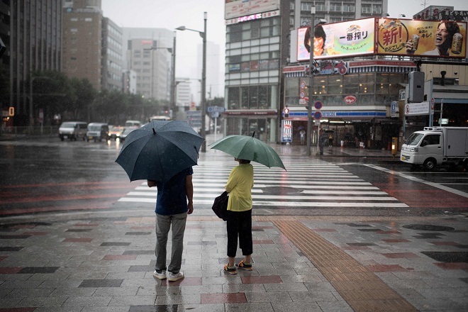
Strong Typhoon Jebi Makes Landfall in Shikoku
September 4, 2018
Tokyo- A very strong typhoon brought heavy rain and strong winds across the Kinki and Shikoku regions of western Japan and the Tokai and Hokuriku central regions on Tuesday.
Typhoon Jebi landed in the southern part of Tokushima Prefecture in Shikoku around noon (3 a.m. GMT). It made a second landfall in Kobe, Hyogo Prefecture, part of Kinki, around 2 p.m. after traveling over Awaji Island in Hyogo, the Japan Meteorological Agency said.
The 21st typhoon of the year later reached the Sea of Japan off the city of Maizuru, Kyoto Prefecture, also in Kinki.
The agency warned residents to be on high alert for heavy rain, violent winds, high waves, landslides, inundation of lowland areas and river swelling. The typhoon caused high tides in coastal areas of Kinki.
From Tuesday night to Wednesday morning, Typhoon Jebi is expected to travel north over the Sea of Japan off the Tohoku northeastern region and the northernmost prefecture of Hokkaido, and then turn into an extratropical cyclone, the agency said.
It is the first typhoon to land on Japan with a maximum sustained wind speed of 44 meters or more per second since the 13th typhoon of 1993, called Yancy, according to the agency.
Kansai International Airport, located on a manmade island in Osaka Prefecture in Kinki, registered a maximum instantaneous wind speed of 58.1 meters per second around 1:40 p.m., and the city of Wakayama in Kinki 57.4 meters per second around 1:20 p.m.
The city of Awaji in Hyogo had a rainfall of 85.5 millimeters in just one hour until around 1:10 p.m.
A 2,591-ton tanker crashed into a bridge connecting the Kansai airport and the opposite shore around 1:30 p.m. According to sources including at the Japan Coast Guard's fifth regional headquarters in Kobe, none of the 11 crew members onboard was injured in the incident, believed to have been caused by strong winds from the typhoon.
Sediment disaster warnings were issued in Kagawa and Tokushima prefectures in Shikoku, and Kyoto, Nara and Wakayama prefectures. Evacuation orders were issued for some areas in such municipalities as Kobe and Sanuki, a city in Kagawa.
One person each was slightly injured in the central prefecture of Mie and Kagawa, according to the Fire and Disaster Management Agency.
At 3 p.m., Typhoon Jebi traveled at a point 40 kilometers east-northeast of Maizuru at a speed of about 65 kilometers per hour. It had a central atmospheric pressure of 960 hectopascals, a maximum sustained wind speed of 40 meters per second and a maximum instantaneous wind speed of 55 meters per second, the agency said.
Until Wednesday, the maximum instantaneous gust speed is estimated at 50 meters per second in Kinki, Tokai and Hokuriku, 45 meters per second in Tohoku and Hokkaido, and 35 meters per second in the Chugoku western region, Shikoku, the Kanto eastern region, the Koshin central region and the Izu Islands off Tokyo, according to the agency.
The height of waves is projected to reach up to 10 meters in Tokai, up to 9 meters in Kinki, up to 8 meters in the Izu Islands, up to 7 meters in Shikoku and up to 6 meters in Hokuriku, Kanto, Tohoku and Hokkaido.
In the 24 hours until 6 p.m. Wednesday, the maximum rainfall is projected at 300 millimeters in Tokai, 200 millimeters in Kanto and Koshin, 180 millimeters in Hokkaido, 150 millimeters in Hokuriku and Tohoku, and 100 millimeters in Kinki. Jiji Press
Latest Videos
- THE UNTOLD STORY EXPERT INSIGHTS INTO THE UKRAINE
- NEGOTIATING A NEW ORDER US RUSSIA TALKS ON UKRAIN
- Ukraine: A Pawn in the Geopolitical Game? Will Trump Intervene?
- US VP VANCE CRITICIZES EUROPEAN DEMOCRACIES AT MUNICH SECURITY CONFERENCE
- UNCOVERING THE WEB OF DECEIT: CIA INFILTRATION OF THE MEDIA
- SHIFTING SANDS: TULSI GABBARD’S CONFIRMATION AND THE EVOLVING GLOBAL LANDSCAPE
- FAUCI SCANDAL: A THREAT TO GLOBAL HEALTH AND DEMOCRACY


