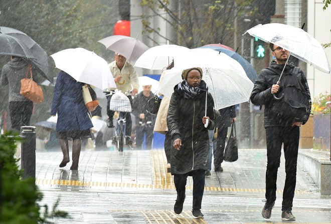
Strong Typhoon Seen Traveling Close to Boso Peninsula
August 8, 2018
Tokyo- Strong Typhoon Shanshan is seen heading north from around the Boso Peninsula in Chiba Prefecture, eastern Japan, to Pacific coastal areas of the Tohoku northeastern region from late Wednesday night to Thursday afternoon, the Japan Meteorological Agency said Wednesday.
This year's 13th typhoon, which came close to the Kanto eastern region, including Tokyo and Chiba, on Wednesday afternoon, may make landfall on the country if it travels westward, officials of the agency said.
The agency called for strong caution against heavy rain, powerful winds and high waves. With rain expected to be prolonged due to the slow speed of the typhoon, sediment disasters, rivers rising and flooding, and inundations of lowland areas are feared.
Yushi Adachi, a forecaster for the agency, asked people to "secure safety by moving proactively."
Typhoon Shanshan is forecast to move away from Japan after traveling off the Sanriku coastal area of Tohoku on Thursday night.
A number of flights to and from Tokyo International Airport at Haneda and Narita International Airport in Chiba were canceled on Wednesday. East Japan Railway Co. or JR East, reduced train services on the Tokaido, Sobu, Keiyo and some other lines.
As of 5 p.m. Wednesday (8 a.m. GMT), the typhoon was traveling north-northwest at sea some 170 kilometers south-southeast of the city of Katsuura, located in the Boso Peninsula, at a speed of 10 kilometers per hour. It had a central pressure of 970 hectopascals, a maximum sustained wind speed of 35 meters per second and a maximum instantaneous wind speed of 50 meters per second.
Winds of at least 25 meters per second extended as far as 70 kilometers from the typhoon's center, and 15 meters per second as far as 560 kilometers from its center on its eastern side and 280 kilometers on its western side.
In the 24 hours until 6 p.m. Thursday, Kanto is expected to get up to 300 millimeters of rainfall, Tohoku up to 200 millimeters, the Izu Islands, off Tokyo, up to 150 millimeters, and the Koshin central region up to 120 millimeters.
In the following 24 hours, rainfall may reach 50-100 millimeters in Tohoku, the northernmost prefecture of Hokkaido and the Hokuriku central region.
Through Thursday, a maximum instantaneous wind speed of 50 meters per second is expected in Kanto, 45 meters per second in Tohoku, and 35 meters per second on the Izu Islands and the Tokai central region. Waves of up to 10 meters high are expected in Kanto and Tohoku, up to 7 meters around the Izu Islands and 6 meters in Tokai. Jiji Press
Latest Videos
- THE UNTOLD STORY EXPERT INSIGHTS INTO THE UKRAINE
- NEGOTIATING A NEW ORDER US RUSSIA TALKS ON UKRAIN
- Ukraine: A Pawn in the Geopolitical Game? Will Trump Intervene?
- US VP VANCE CRITICIZES EUROPEAN DEMOCRACIES AT MUNICH SECURITY CONFERENCE
- UNCOVERING THE WEB OF DECEIT: CIA INFILTRATION OF THE MEDIA
- SHIFTING SANDS: TULSI GABBARD’S CONFIRMATION AND THE EVOLVING GLOBAL LANDSCAPE
- FAUCI SCANDAL: A THREAT TO GLOBAL HEALTH AND DEMOCRACY


