


Another weather disturbance entering Philippines
July 20, 2018
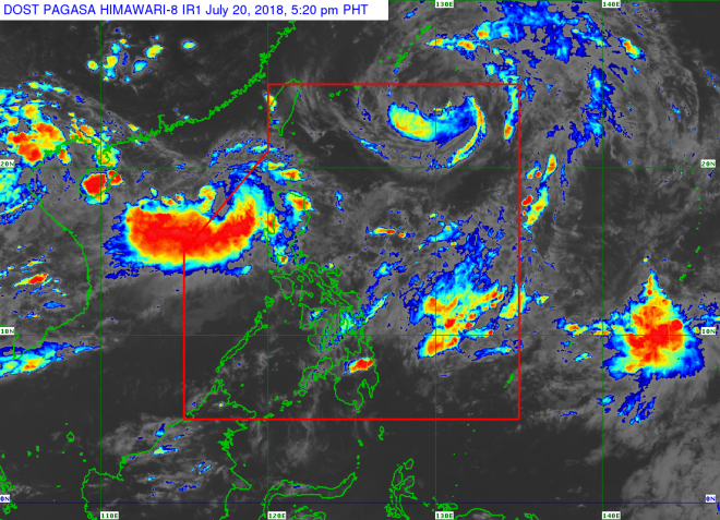
Another weather disturbance is expected to enter the Philippine Area of Responsibility as Tropical Storm Inday moves towards China, a state weather forecaster said on Friday.
Nikos Penaranda said a low pressure area was spotted at 435 km west of Laoag, Ilocos Norte or at the southern area of Hong Kong. It is expected to enter the Philippine Area of Responsibility by Saturday.
He said the low pressure area is expected to move closer to Northern Luzon.
Penaranda added that the low pressure area is less likely to develop into tropical depression and may dissipate by Saturday evening or Sunday morning.
There is also a small possibility that it will reform at the east of Cagayan province by Sunday to early Monday, Penaranda said.
Tropical Storm Inday was last spotted at 945 km east northeast of Basco, Batanes with maximum winds of 90 kph and gusts of up to 115 kph while moving slowly northwest with central pressure of 986 hectopascals.
Penaranda said Inday is expected to leave the Philippine Area of Responsibility by early Saturday and make landfall in China by Sunday morning.
He said the weather disturbances are expected to enhance the southwest monsoon and bring monsoon rains in different parts of Luzon, especially the western section of northern and central Luzon until Saturday. Robina Asido/DMS
Latest Videos
- THE UNTOLD STORY EXPERT INSIGHTS INTO THE UKRAINE
- NEGOTIATING A NEW ORDER US RUSSIA TALKS ON UKRAIN
- Ukraine: A Pawn in the Geopolitical Game? Will Trump Intervene?
- US VP VANCE CRITICIZES EUROPEAN DEMOCRACIES AT MUNICH SECURITY CONFERENCE
- UNCOVERING THE WEB OF DECEIT: CIA INFILTRATION OF THE MEDIA
- SHIFTING SANDS: TULSI GABBARD’S CONFIRMATION AND THE EVOLVING GLOBAL LANDSCAPE
- FAUCI SCANDAL: A THREAT TO GLOBAL HEALTH AND DEMOCRACY
![]()
