


Tropical depression Basyang weakens as it moves towards Bohol Sea
February 13, 2018
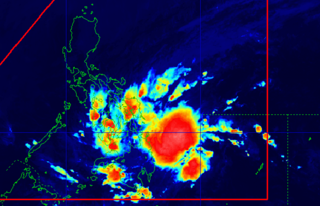
The Philippine Atmospheric, Geophysical and Astronomical Services Administration ( Pagasa) on Tuesday said tropical depression Basyang weakened as it traverses Bohol Sea.
In a press briefing, weather forecaster Aldczar Aurelio said Basyang was spotted at 25km southeast of Tagbilaran City, Bohol with maximum sustained winds up to 45 kph and gusts up to 65 kph.
It is forecast to move west at 27kph.
Aurelio said Basyang could make landfall in Bohol, southern portion of Cebu and Negros provinces before heading to Palawan for its last landfall expected on Wednesday.
He added Basyang is expected to leave the Philippine Area of Responsibility by Thursday and will intensify into a tropical storm.
Tropical Cyclone Warning Signal Number One is up over Palawan including Calamian and Cuyo group of islands, Akalan, Capiz, Antique, Iloilo, Guimaras, Negros Occidental, Negros Oriental, Siquijor, Bohol, Cebu, Biliran, Leyte, Southern Leyte, Camiguin, Misamis Oriental, Misamis Occidental and northern section of Zamboanga del Norte.
Areas in Palawan and Visayas will experience scattered to widespread moderate to heavy rains while scattered light to moderate with heavy rains are expected over Zamboanga Peninsula, northern Mindanao, Caraga and the provinces of Basilan, Sulu, and Tawi-Tawi.
Pagasa advised the public to take appropriate measures against possible flooding and landslides. Ella Dionisio/DMS
Latest Videos
- THE UNTOLD STORY EXPERT INSIGHTS INTO THE UKRAINE
- NEGOTIATING A NEW ORDER US RUSSIA TALKS ON UKRAIN
- Ukraine: A Pawn in the Geopolitical Game? Will Trump Intervene?
- US VP VANCE CRITICIZES EUROPEAN DEMOCRACIES AT MUNICH SECURITY CONFERENCE
- UNCOVERING THE WEB OF DECEIT: CIA INFILTRATION OF THE MEDIA
- SHIFTING SANDS: TULSI GABBARD’S CONFIRMATION AND THE EVOLVING GLOBAL LANDSCAPE
- FAUCI SCANDAL: A THREAT TO GLOBAL HEALTH AND DEMOCRACY
![]()
