


”Chedeng” heads towards Davao Oriental
March 18, 2019
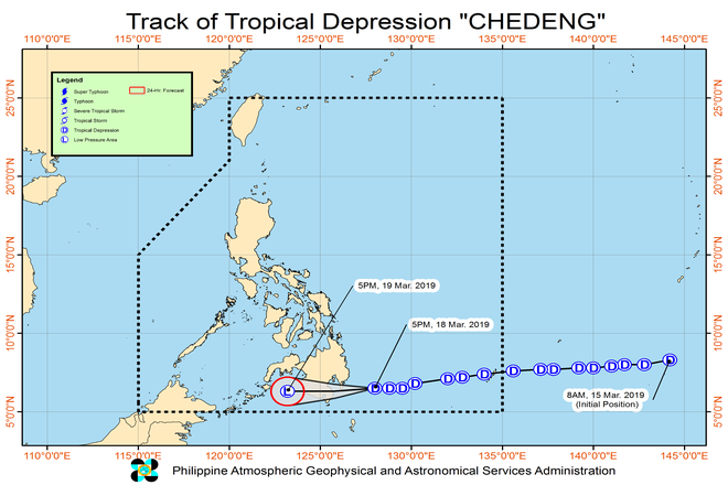
Tropical Depression ''Chedeng'' slowed down as it heads westward towards Davao Oriental, the Philippine Atmospheric, Geophysical and Astronomical Services Administration ( Pagasa) said on Monday.
According to the weather bureau, the center of ''Chedeng'' was seen at 285 kilometers east southeast of Davao City.
It was moving west at 15 kilometers per hour with winds of up to 45 kilometers per hour and gusts of up to 60 kilometers per hour.
''Chedeng'' is expected to make landfall on Tuesday morning at southeastern coast of Davao Oriental or the eastern coast of Davao Occidental. Pagasa says it is expected to weaken into a low pressure area as it moves across Mindanao.
Pagasa expects ''Chedeng'' will bring scattered rains to moderate or heavy rains over most parts of Mindanao, including Davao Region, Soccsksargen, Bangsamoro and Zamboanga Peninsula.
Pagasa said Davao Oriental, Compostella Valley, Davao del Sur, Davao City, General Santos City, Davao Occidental, southern parts of Davao del Norte including Samal Island, eastern portion of North Cotabato, eastern portion of South Cotabato, eastern portion of Sarangani and eastern portion of Sultan Kudarat are under tropical cyclone warning signal number one.
Strong gusts of wind and rain may trigger floods and landslides in these areas, Pagasa said. Cristina Eloisa Baclig/DMS
Latest Videos
- THE UNTOLD STORY EXPERT INSIGHTS INTO THE UKRAINE
- NEGOTIATING A NEW ORDER US RUSSIA TALKS ON UKRAIN
- Ukraine: A Pawn in the Geopolitical Game? Will Trump Intervene?
- US VP VANCE CRITICIZES EUROPEAN DEMOCRACIES AT MUNICH SECURITY CONFERENCE
- UNCOVERING THE WEB OF DECEIT: CIA INFILTRATION OF THE MEDIA
- SHIFTING SANDS: TULSI GABBARD’S CONFIRMATION AND THE EVOLVING GLOBAL LANDSCAPE
- FAUCI SCANDAL: A THREAT TO GLOBAL HEALTH AND DEMOCRACY
![]()
